Boscombe: a little bit of then & now - top of Haviland Rd West c.1988 (5)
Introduction
The photograph on this page of Boscombe: a little bit of then & now - top of Haviland Rd West c.1988 (5) by Mike Searle as part of the Geograph project.
The Geograph project started in 2005 with the aim of publishing, organising and preserving representative images for every square kilometre of Great Britain, Ireland and the Isle of Man.

There are currently over 7.5m images from over 14,400 individuals and you can help contribute to the project by visiting https://www.geograph.org.uk
Boscombe: a little bit of then & now - top of Haviland Rd West c.1988 (5)
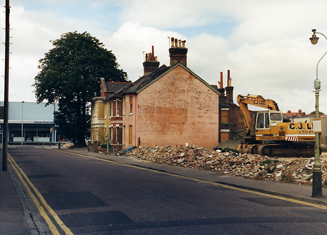
Image: © Mike Searle Taken: Unknown
Site clearance in operation preparatory to the Boscombe Sovereign Centre development, a key component of the controversial Boscombe Plan of the late 1980s. The view is of Haviland Road West near its junction with Palmerston Road. The old Hendy Ford/Hendy Lennox garage in Palmerston Road is on the left. The same view today: Image] NEXT: Image
Images are licensed for reuse under creativecommons.org/licenses/by-sa/2.0
Image Location
Latitude
50.726523
Longitude
-1.84127