Lifting bridge, Surrey Docks
Introduction
The photograph on this page of Lifting bridge, Surrey Docks by Malc McDonald as part of the Geograph project.
The Geograph project started in 2005 with the aim of publishing, organising and preserving representative images for every square kilometre of Great Britain, Ireland and the Isle of Man.

There are currently over 7.5m images from over 14,400 individuals and you can help contribute to the project by visiting https://www.geograph.org.uk
Lifting bridge, Surrey Docks
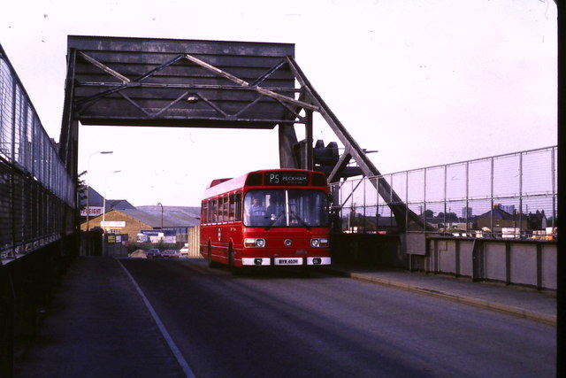
Image: © Malc McDonald Taken: 31 Jul 1985
This lifting bridge used to carry Redriff Road across the canal leading into Surrey Docks. Since the docks have closed down, there is no longer any need for the bridge to lift. In 1985, when this image was taken, the road still crossed the bridge. The road has since been diverted the lifting bridge. The lifting bridge is still in place today, part of the area's history, but no longer carries the road. The road has been diverted over a new fixed bridge alongside. For a more recent image of the bridge, have a look at Image The warehouses in the background have also been demolished. The area which they occupied has beben redeveloped and is now a leisure park with restaurants, a bowling alley, cinema and bingo hall.
Images are licensed for reuse under creativecommons.org/licenses/by-sa/2.0
Image Location
Latitude
51.494264
Longitude
-0.044765