Huthwaite, Sutton-in-Ashfield NG17, Notts.
Introduction
The photograph on this page of Huthwaite, Sutton-in-Ashfield NG17, Notts. by David Hallam-Jones as part of the Geograph project.
The Geograph project started in 2005 with the aim of publishing, organising and preserving representative images for every square kilometre of Great Britain, Ireland and the Isle of Man.

There are currently over 7.5m images from over 14,400 individuals and you can help contribute to the project by visiting https://www.geograph.org.uk
Huthwaite, Sutton-in-Ashfield NG17, Notts.
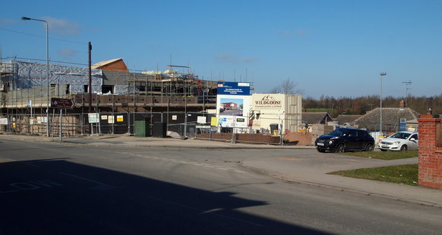
Image: © David Hallam-Jones Taken: 2 Mar 2013
A plot of rough ground until recently, this brown-field corner site at the junction of Skegby Road with the B6026 (Sutton Road) is being used to host the new £2.6m, two-storey Huthwaite Medical Centre. When completed in "Spring 2013" it will replace the G.P. practice premises on nearby New Street and it will include an on-site retail pharmacy. A two-three minute walk down Skegby Road, past the parked cars, leads to The Brierley Forest Park visitors' centre on the edge of this large nature reserve. The colliery on which the reserve was developed was known locally as "Brierley Pit" because many of the first miners came from Brierley Hill in Staffordshire in the early 1870s.
Images are licensed for reuse under creativecommons.org/licenses/by-sa/2.0
Image Location
Latitude
53.128605
Longitude
-1.296352