Bourton Near Bishops Cannings
Introduction
The photograph on this page of Bourton Near Bishops Cannings by Gillie Rhodes as part of the Geograph project.
The Geograph project started in 2005 with the aim of publishing, organising and preserving representative images for every square kilometre of Great Britain, Ireland and the Isle of Man.

There are currently over 7.5m images from over 14,400 individuals and you can help contribute to the project by visiting https://www.geograph.org.uk
Bourton Near Bishops Cannings
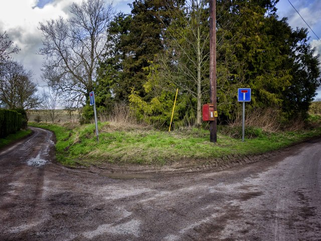
Image: © Gillie Rhodes Taken: 14 Feb 2013
This fork in the road is just North of the small hamlet of Bourton which in turn is just to the North of Bishops Cannings at the foot of Roughridge Hill at the West end of the Vale of Pewsey. The lane comes from Bishops Cannings and splits at this point, the left going a short way to a track then a path leading up Roghridge Hill and the right leads to Easton Farm. As can be seen from the signs in the picture both ways are dead ends.
Images are licensed for reuse under creativecommons.org/licenses/by-sa/2.0
Image Location
Latitude
51.381154
Longitude
-1.938883