Millennium chronolog
Introduction
The photograph on this page of Millennium chronolog by Graham Horn as part of the Geograph project.
The Geograph project started in 2005 with the aim of publishing, organising and preserving representative images for every square kilometre of Great Britain, Ireland and the Isle of Man.

There are currently over 7.5m images from over 14,400 individuals and you can help contribute to the project by visiting https://www.geograph.org.uk
Millennium chronolog
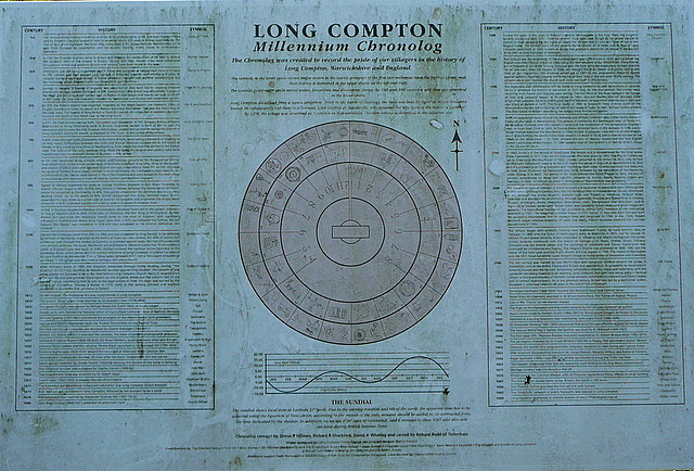
Image: © Graham Horn Taken: 17 Feb 2013
Nearby is this edifice Image] which is called the Millennium chronolog. Here is the information board explaining the events of the last 2,000 years in Long Compton that have inspired it. We are walking Shakespeare's Way, but even if he came this way he would not have known the events of almost the last quarter of this time frame.
Images are licensed for reuse under creativecommons.org/licenses/by-sa/2.0
Image Location
Latitude
51.990027
Longitude
-1.580979