Molehills and Lomond Hills
Introduction
The photograph on this page of Molehills and Lomond Hills by William Starkey as part of the Geograph project.
The Geograph project started in 2005 with the aim of publishing, organising and preserving representative images for every square kilometre of Great Britain, Ireland and the Isle of Man.

There are currently over 7.5m images from over 14,400 individuals and you can help contribute to the project by visiting https://www.geograph.org.uk
Molehills and Lomond Hills
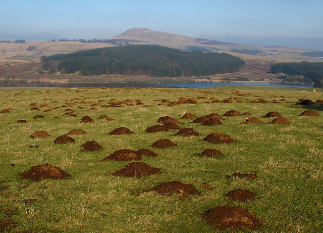
Image: © William Starkey Taken: 19 Feb 2013
Molehills on grazing land near West Balgothrie, with East Lomond Hill visible in the distance. It is estimated that a mole may excavate six kilogrammes of soil in twenty minutes - fifty times the weight of the mole itself (*) - the moles inhabiting this field have certainly been very active. * Reference: The Mole, by Kenneth Mellanby, Collins New Naturalist, Glasgow, 1973.
Images are licensed for reuse under creativecommons.org/licenses/by-sa/2.0
Image Location
Latitude
56.212707
Longitude
-3.259635