Former Derby Canal, Sandiacre, Derbys.
Introduction
The photograph on this page of Former Derby Canal, Sandiacre, Derbys. by David Hallam-Jones as part of the Geograph project.
The Geograph project started in 2005 with the aim of publishing, organising and preserving representative images for every square kilometre of Great Britain, Ireland and the Isle of Man.

There are currently over 7.5m images from over 14,400 individuals and you can help contribute to the project by visiting https://www.geograph.org.uk
Former Derby Canal, Sandiacre, Derbys.
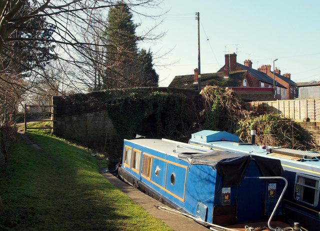
Image: © David Hallam-Jones Taken: 17 Feb 2013
The remaining easterly end of the Derby Canal at its junction with the Erewash Canal. The Sandiacre Lock and Lock Cottages lie immediately behind the photographer. This canal stump, known as the "Derby Arm Moorings", provides private moorings for 4-5 canal boats. The majority of the former Derby Canal lies beyond "Sandiacre Bottom Lock" that was previously existed on the other side of the blocked-off tunnel ahead. The Derby Canal was filled in during the late 1960s and now provides a walking & cycling trail in the Longmoor Road direction. To the right, Lock Lane passes over this bridge leading traffic onto Longmoor Road (the B6002), whereas walkers turning left quickly arrive at the rear of Lock Cottages and Sandiacre Lock itself.
Images are licensed for reuse under creativecommons.org/licenses/by-sa/2.0
Image Location
Latitude
52.917199
Longitude
-1.285059