Charlton Junction
Introduction
The photograph on this page of Charlton Junction by Stephen Craven as part of the Geograph project.
The Geograph project started in 2005 with the aim of publishing, organising and preserving representative images for every square kilometre of Great Britain, Ireland and the Isle of Man.

There are currently over 7.5m images from over 14,400 individuals and you can help contribute to the project by visiting https://www.geograph.org.uk
Charlton Junction
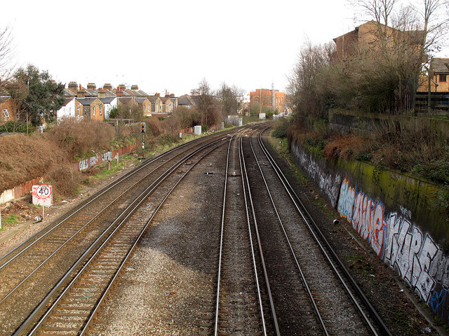
Image: © Stephen Craven Taken: 17 Feb 2013
A view eastwards from Victoria Way bridge, to where the two lines join just west of Charlton station. The tracks on the right are on the original route from London via Blackheath in 1849; the gap from Greenwich to here (the tracks on the left) was filled in 1873. There is a 40mph speed restriction sign to the left. See Image for the view in the other direction from the same bridge.
Images are licensed for reuse under creativecommons.org/licenses/by-sa/2.0
Image Location
Latitude
51.485591
Longitude
0.02645