The railway line at Levenvale
Introduction
The photograph on this page of The railway line at Levenvale by Lairich Rig as part of the Geograph project.
The Geograph project started in 2005 with the aim of publishing, organising and preserving representative images for every square kilometre of Great Britain, Ireland and the Isle of Man.

There are currently over 7.5m images from over 14,400 individuals and you can help contribute to the project by visiting https://www.geograph.org.uk
The railway line at Levenvale
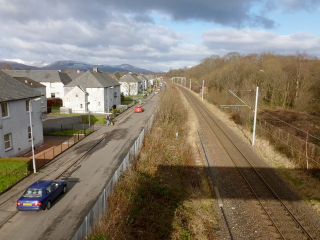
Image: © Lairich Rig Taken: 6 Feb 2013
The photograph was taken from a Image; its shadow is in the right foreground. Burns Street, which forms the eastern edge of Levenvale, is to the left of the line. The dog-walker is passing Wilkie Place, a block that is set back slightly from Burns street. Not far beyond this point, after passing Levenvale, the railway line now terminates at Balloch Station, although it used to go further. [It used to go as far as Balloch Pier Station (now gone), beside Loch Lomond. The present-day Balloch Station building did not then exist; the Balloch Central Station of that day now serves as Image, and the level crossing that was next to it has also been removed.] The area visible to the right of the line is Fishers Wood; on that side, the footbridge leads to the northern end of Rosshead. See Image for a view of it from the other side.
Images are licensed for reuse under creativecommons.org/licenses/by-sa/2.0
Image Location
Latitude
55.997773
Longitude
-4.580896