Stratton's Folly, from the south-west
Introduction
The photograph on this page of Stratton's Folly, from the south-west by Stefan Czapski as part of the Geograph project.
The Geograph project started in 2005 with the aim of publishing, organising and preserving representative images for every square kilometre of Great Britain, Ireland and the Isle of Man.

There are currently over 7.5m images from over 14,400 individuals and you can help contribute to the project by visiting https://www.geograph.org.uk
Stratton's Folly, from the south-west
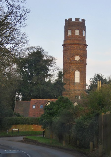
Image: © Stefan Czapski Taken: 17 Feb 2013
According to the Hertfordshire volume of Pevsner's 'The Buildings of England', the tower was the brain-child of one John Stratton, and dates from 1789.
Images are licensed for reuse under creativecommons.org/licenses/by-sa/2.0
Image Location
Latitude
51.756628
Longitude
-0.125316