Hewitt Road
Introduction
The photograph on this page of Hewitt Road by Martin Addison as part of the Geograph project.
The Geograph project started in 2005 with the aim of publishing, organising and preserving representative images for every square kilometre of Great Britain, Ireland and the Isle of Man.

There are currently over 7.5m images from over 14,400 individuals and you can help contribute to the project by visiting https://www.geograph.org.uk
Hewitt Road
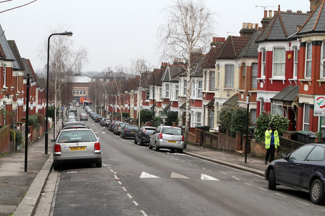
Image: © Martin Addison Taken: 12 Feb 2013
One of the streets built circa 1880 as part of the Harringay Park development between Green Lanes and the Great northern mainline. This network of streets is also referred to as the Harringay Ladder because of their ground plan. This view is looking down the hill towards Green Lanes.
Images are licensed for reuse under creativecommons.org/licenses/by-sa/2.0
Image Location
Latitude
51.582529
Longitude
-0.102467