Cornish's Grave bridge
Introduction
The photograph on this page of Cornish's Grave bridge by Neil Owen as part of the Geograph project.
The Geograph project started in 2005 with the aim of publishing, organising and preserving representative images for every square kilometre of Great Britain, Ireland and the Isle of Man.

There are currently over 7.5m images from over 14,400 individuals and you can help contribute to the project by visiting https://www.geograph.org.uk
Cornish's Grave bridge
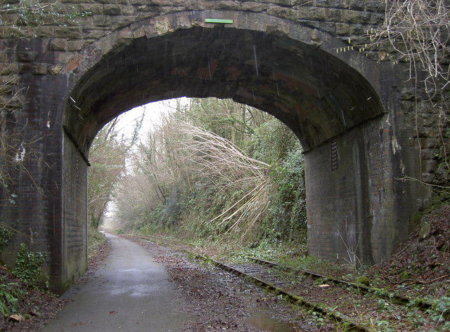
Image: © Neil Owen Taken: 11 Feb 2013
Once the old colliers' line saw trains running along the tracks but today is now National Cycle Network Route 24. A projecting bracket can be found low down on the corner of the wall to the left of shot - see Image
Images are licensed for reuse under creativecommons.org/licenses/by-sa/2.0
Image Location
Latitude
51.260843
Longitude
-2.414841