Penkford Canal Bridge
Introduction
The photograph on this page of Penkford Canal Bridge by David Dixon as part of the Geograph project.
The Geograph project started in 2005 with the aim of publishing, organising and preserving representative images for every square kilometre of Great Britain, Ireland and the Isle of Man.

There are currently over 7.5m images from over 14,400 individuals and you can help contribute to the project by visiting https://www.geograph.org.uk
Penkford Canal Bridge
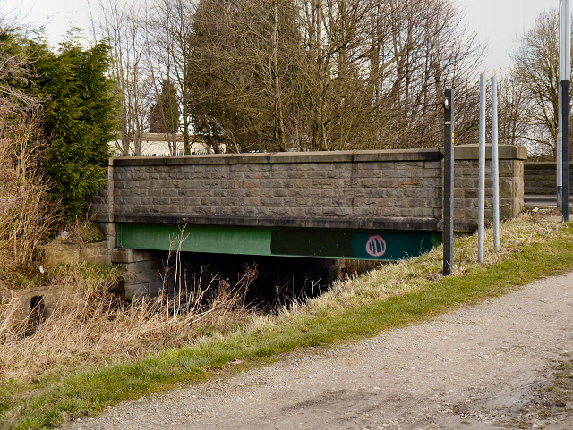
Image: © David Dixon Taken: 2 Feb 2013
Penkford Bridge which carries the A572 road from St Helens to Newton-le-Willows over the Sankey Canal. Originally, this would have been a swing bridge to accommodate the Mersey Flats sailboats which used the canal when it was first built. After this section of the canal became disused in the 1920s and 30s and the swingbridges were replaced by fixed bridges such as this one.
Images are licensed for reuse under creativecommons.org/licenses/by-sa/2.0
Image Location
Latitude
53.449661
Longitude
-2.66083