Newton Common Lock Information Board
Introduction
The photograph on this page of Newton Common Lock Information Board by David Dixon as part of the Geograph project.
The Geograph project started in 2005 with the aim of publishing, organising and preserving representative images for every square kilometre of Great Britain, Ireland and the Isle of Man.

There are currently over 7.5m images from over 14,400 individuals and you can help contribute to the project by visiting https://www.geograph.org.uk
Newton Common Lock Information Board
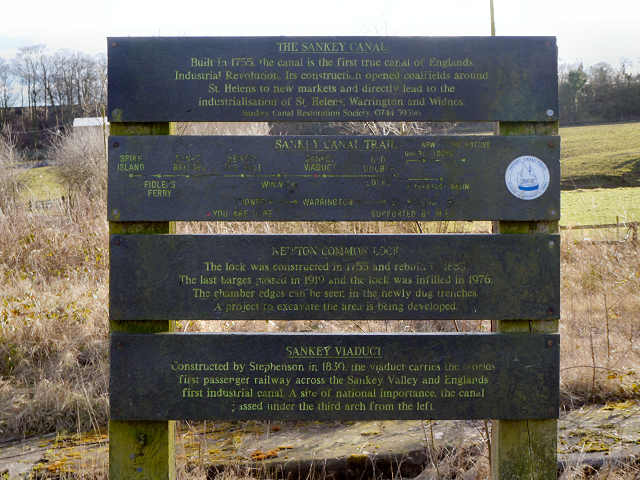
Image: © David Dixon Taken: 2 Feb 2013
Information board standing above the remains of Image] giving details about the lock, Sankey Viaduct and Sankey Canal.
Images are licensed for reuse under creativecommons.org/licenses/by-sa/2.0
Image Location
Latitude
53.44879
Longitude
-2.655697