Corby station, as in 1990
Introduction
The photograph on this page of Corby station, as in 1990 by Ben Brooksbank as part of the Geograph project.
The Geograph project started in 2005 with the aim of publishing, organising and preserving representative images for every square kilometre of Great Britain, Ireland and the Isle of Man.

There are currently over 7.5m images from over 14,400 individuals and you can help contribute to the project by visiting https://www.geograph.org.uk
Corby station, as in 1990
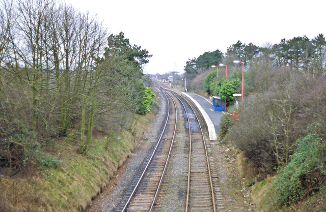
Image: © Ben Brooksbank Taken: 19 Feb 1990
View southward, towards Kettering, Bedford and London: ex-Midland (St Pancras) - Kettering - Melton Mowbray - Nottingham etc. main line. Named Corby & Weldon until 4/3/57 and closed 18/4/66. Kettering - Melton Mowbray - Leicester was closed to passenger traffic 6/6/66. Corby then had the distinction of being one of the three largest towns in Europe without a railway station, but the line remained open for freight and for diversions, Glendon South Junction near Kettering - Corby as a single line. From 11/4/87 until 2/6/90 a DMU shuttle was run by the Corby Council to/from Kettering. In 2008 an entirely new station was built at Corby and from 23/2/09 a regular service has been run by East Midlands Trains to London St Pancras, with limited services to Oakham and Melton Mowbray. The photograph shows the single Down side platform of the 'minimal' station in 1990.
Images are licensed for reuse under creativecommons.org/licenses/by-sa/2.0
Image Location
Latitude
52.48858
Longitude
-0.688343