Trowell NG9, Notts
Introduction
The photograph on this page of Trowell NG9, Notts by David Hallam-Jones as part of the Geograph project.
The Geograph project started in 2005 with the aim of publishing, organising and preserving representative images for every square kilometre of Great Britain, Ireland and the Isle of Man.

There are currently over 7.5m images from over 14,400 individuals and you can help contribute to the project by visiting https://www.geograph.org.uk
Trowell NG9, Notts
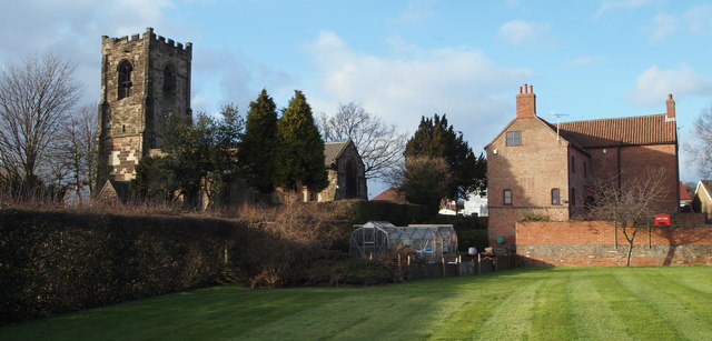
Image: © David Hallam-Jones Taken: 31 Jan 2013
South-easterly aspects of St Helen's Church and Wilnefield House (the greatly extended, one-time village rectory or vicarage) as seen from a field belonging to the present owner of Wilnefield House. The word Wilne is thought to be related to the word willow. Harvey Grove, a residential cul-de-sac beyond a boundary fence that is situated behind the photographer was named using the surname of the present owner's father.
Images are licensed for reuse under creativecommons.org/licenses/by-sa/2.0
Image Location
Latitude
52.952773
Longitude
-1.281049