Foley, Fenton, Stoke-on-Trent
Introduction
The photograph on this page of Foley, Fenton, Stoke-on-Trent by Steven Birks as part of the Geograph project.
The Geograph project started in 2005 with the aim of publishing, organising and preserving representative images for every square kilometre of Great Britain, Ireland and the Isle of Man.

There are currently over 7.5m images from over 14,400 individuals and you can help contribute to the project by visiting https://www.geograph.org.uk
Foley, Fenton, Stoke-on-Trent
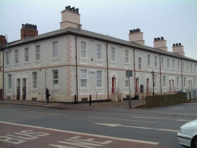
Image: © Steven Birks Taken: Unknown
The area known as "The Foley" is centred on King Street, near the Longton boundary. By the 1830's there were several potworks and some large houses. Foley Place Foley Place is near the east end of King Street and was probably built in the 1830's or 1840's and is an example of middle-class housing with some attempt at a formal layout, rare in the Potteries at that date. It consists of an L-shaped block of two-stories stucco houses with basements, late Georgian in style. There were originally eleven houses and an inn, the 'Foley Arms,' while a communal garden (now covered by a garage and petrol station) was laid out to the west.
Images are licensed for reuse under creativecommons.org/licenses/by-sa/2.0
Image Location


Leaflet Map data © OpenStreetMap
Latitude
52.992346
Longitude
-2.141487