Lurking under the arches
Introduction
The photograph on this page of Lurking under the arches by David Liddle as part of the Geograph project.
The Geograph project started in 2005 with the aim of publishing, organising and preserving representative images for every square kilometre of Great Britain, Ireland and the Isle of Man.

There are currently over 7.5m images from over 14,400 individuals and you can help contribute to the project by visiting https://www.geograph.org.uk
Lurking under the arches
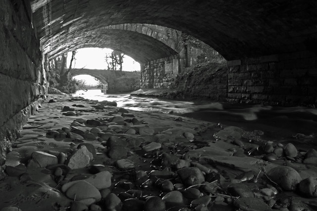
Image: © David Liddle Taken: 28 Jan 2013
Three bridges together. The nearest is the main A7 road bridge the middle one is the old Waverley line rail bridge and the furthest away is an old farm track.
Images are licensed for reuse under creativecommons.org/licenses/by-sa/2.0
Image Location
Latitude
55.031458
Longitude
-2.969317