Assarts, Malvern Wells
Introduction
The photograph on this page of Assarts, Malvern Wells by Bob Embleton as part of the Geograph project.
The Geograph project started in 2005 with the aim of publishing, organising and preserving representative images for every square kilometre of Great Britain, Ireland and the Isle of Man.

There are currently over 7.5m images from over 14,400 individuals and you can help contribute to the project by visiting https://www.geograph.org.uk
Assarts, Malvern Wells
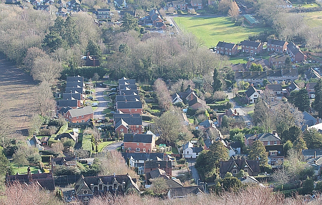
Image: © Bob Embleton Taken: 27 Jan 2013
The area gets its name, Assarts, from the medieval clearance of a section of the Chase (hunting ground) under licence. On the 1841 Welland Tithe Map it is marked as Upper Assart Common. A decade later the Welland Inclosure Act allowed the common land to be exploited and it has slowly been consumed by housing developments. The Assarts playing field (top right) remains open for recreational use, though a corner has been fenced off for the Scout hut. Above that (towards the camera) there are three post war developments:- Heathlands Close, council houses, Wells Close, built by the Co-op I'm told, Woodlands Close, private detached built in the late 1970s. On the left of the photo the recent Homestead Close has been built in what was the garden of the large house "Heathlands". At the very bottom of the photo is the rather ornate Malvern Wells C of E primary school on the main A449 Wells Road.
Images are licensed for reuse under creativecommons.org/licenses/by-sa/2.0
Image Location
Latitude
52.070498
Longitude
-2.332439