Cliff above River Wear, 1968
Introduction
The photograph on this page of Cliff above River Wear, 1968 by Derek Harper as part of the Geograph project.
The Geograph project started in 2005 with the aim of publishing, organising and preserving representative images for every square kilometre of Great Britain, Ireland and the Isle of Man.

There are currently over 7.5m images from over 14,400 individuals and you can help contribute to the project by visiting https://www.geograph.org.uk
Cliff above River Wear, 1968
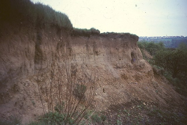
Image: © Derek Harper Taken: 3 May 1968
At the time, this scene above the river southeast of Crichton Avenue had farmland on the clifftop above it; now there is a riverside walk here below housing on The Parks. The river is eroding glacial till here, deposits which, after the last glaciation, probably blocked its course northwards from Chester-le-Street and sent it eastwards to Sunderland. The houses at upper right are at Great Lumley.
Images are licensed for reuse under creativecommons.org/licenses/by-sa/2.0
Image Location
Latitude
54.845826
Longitude
-1.563936