4-4a Church Hill, Patcham
Introduction
The photograph on this page of 4-4a Church Hill, Patcham by Simon Carey as part of the Geograph project.
The Geograph project started in 2005 with the aim of publishing, organising and preserving representative images for every square kilometre of Great Britain, Ireland and the Isle of Man.

There are currently over 7.5m images from over 14,400 individuals and you can help contribute to the project by visiting https://www.geograph.org.uk
4-4a Church Hill, Patcham
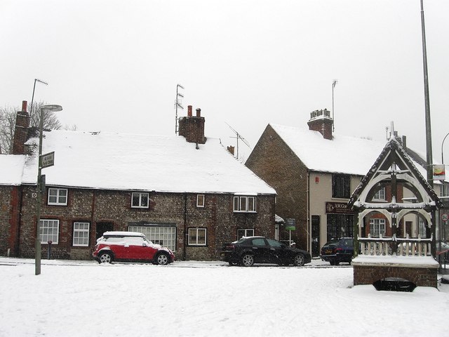
Image: © Simon Carey Taken: 20 Jan 2013
Flint built cottages at the bottom of Church Hill next to the junction with London Road. The buildings date from the 18th century. To the right is Patcham Fountain erected in 1887 to mark Queen Victoria's golden jubilee on the site of a former donkey wheel that operated the village well. The road was once known as Spring Street as it ran next to the Wellesborne, Brighton's lost river, and this part of Patcham can still be prone to flooding today, the last occurrence being during the heavy rains of December 2012.
Images are licensed for reuse under creativecommons.org/licenses/by-sa/2.0
Image Location
Latitude
50.864881
Longitude
-0.152217