Dumbarton West Kirk: former burial ground
Introduction
The photograph on this page of Dumbarton West Kirk: former burial ground by Lairich Rig as part of the Geograph project.
The Geograph project started in 2005 with the aim of publishing, organising and preserving representative images for every square kilometre of Great Britain, Ireland and the Isle of Man.

There are currently over 7.5m images from over 14,400 individuals and you can help contribute to the project by visiting https://www.geograph.org.uk
Dumbarton West Kirk: former burial ground
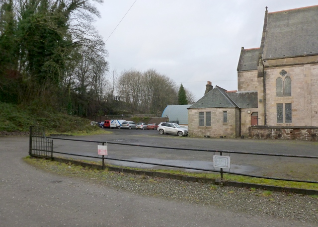
Image: © Lairich Rig Taken: 11 Jan 2013
This area behind the church halls of the West Kirk (Image) was, until recent times, a burial ground. In the 1790s, land was feued here for the building of a church (that building is no longer present, but has been replaced twice since then), and for a burial ground. The building that now serves as church halls (see the link just given) dates from 1860, and was the first of the replacements for the original church. It, in turn, was replaced by the present-day West Kirk, whose rear is visible in the right background of the present photograph. See Image for a view of that building, and for much more information. When the burial ground was surveyed in 1969, there were still numerous memorials here, but it is obvious from this picture that they have been cleared away since then. Only the MacAuslan Memorial and the Buchanan Memorial remain: Image / Image There is also a War Memorial nearby: Image
Images are licensed for reuse under creativecommons.org/licenses/by-sa/2.0
Image Location
Latitude
55.945492
Longitude
-4.579497