Dumbarton West Kirk: church halls
Introduction
The photograph on this page of Dumbarton West Kirk: church halls by Lairich Rig as part of the Geograph project.
The Geograph project started in 2005 with the aim of publishing, organising and preserving representative images for every square kilometre of Great Britain, Ireland and the Isle of Man.

There are currently over 7.5m images from over 14,400 individuals and you can help contribute to the project by visiting https://www.geograph.org.uk
Dumbarton West Kirk: church halls
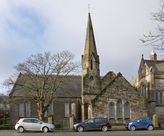
Image: © Lairich Rig Taken: 14 Jan 2013
See Image for another view. This 1860 building by William Spence was the immediate predecessor of the present-day Image (the building on the right), and it now serves as church halls for the West Kirk. For the detail in the right background, see Image
Images are licensed for reuse under creativecommons.org/licenses/by-sa/2.0
Image Location
Latitude
55.945502
Longitude
-4.579017