View from Spout House Hill
Introduction
The photograph on this page of View from Spout House Hill by Dave Pickersgill as part of the Geograph project.
The Geograph project started in 2005 with the aim of publishing, organising and preserving representative images for every square kilometre of Great Britain, Ireland and the Isle of Man.

There are currently over 7.5m images from over 14,400 individuals and you can help contribute to the project by visiting https://www.geograph.org.uk
View from Spout House Hill
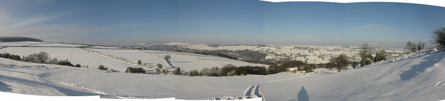
Image: © Dave Pickersgill Taken: 22 Jan 2013
The view from near the disused quarry on Spout House Hill on a snowy day in January. To the left are the Pennines, with Pike Lowe, Ewden Heights and Whitwell Moor. Bolsterstone is on the top of the hill, and Hunshelf Bank beyond.
Images are licensed for reuse under creativecommons.org/licenses/by-sa/2.0
Image Location
Latitude
53.460674
Longitude
-1.589844