Hampstead Road
Introduction
The photograph on this page of Hampstead Road by Simon Carey as part of the Geograph project.
The Geograph project started in 2005 with the aim of publishing, organising and preserving representative images for every square kilometre of Great Britain, Ireland and the Isle of Man.

There are currently over 7.5m images from over 14,400 individuals and you can help contribute to the project by visiting https://www.geograph.org.uk
Hampstead Road
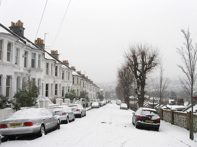
Image: © Simon Carey Taken: 20 Jan 2013
Residential road running downhill from The Drove towards Preston Park station. Needless to say with the snow on the ground other than those walking on the road in the distance there was not much evidence of traffic on this day. The slope of the hill means there is little housing on the southern side, the wall on the right separates the rear of the houses in Kingsley Road which runs parallel.
Images are licensed for reuse under creativecommons.org/licenses/by-sa/2.0
Image Location
Latitude
50.843719
Longitude
-0.156179