Flats above the Mary Seacole Centre
Introduction
The photograph on this page of Flats above the Mary Seacole Centre by Stephen Craven as part of the Geograph project.
The Geograph project started in 2005 with the aim of publishing, organising and preserving representative images for every square kilometre of Great Britain, Ireland and the Isle of Man.

There are currently over 7.5m images from over 14,400 individuals and you can help contribute to the project by visiting https://www.geograph.org.uk
Flats above the Mary Seacole Centre
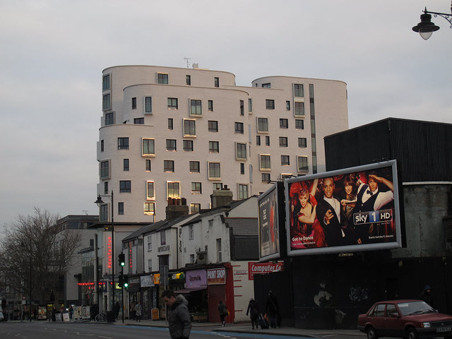
Image: © Stephen Craven Taken: 13 Jan 2013
A recent medium-rise development, above the Mary Seacole Centre on the corner of Clapham High Street and St Luke's Avenue, opened in 2012. The whole site is called Clapham One, "a public private partnership scheme between the London Borough of Lambeth, Cathedral Group Plc and United House Limited ... a new 20,000 sq ft health centre, library, leisure centre and 199 new homes" (from the architects' website). The building in the right foreground looks uninteresting and abandoned; in fact (according to another contributor to this site) it was the entrance to a WW2 deep level air raid shelter Image
Images are licensed for reuse under creativecommons.org/licenses/by-sa/2.0
Image Location
Latitude
51.463073
Longitude
-0.133916