Hunters Farm, Wilford
Introduction
The photograph on this page of Hunters Farm, Wilford by Alan Murray-Rust as part of the Geograph project.
The Geograph project started in 2005 with the aim of publishing, organising and preserving representative images for every square kilometre of Great Britain, Ireland and the Isle of Man.

There are currently over 7.5m images from over 14,400 individuals and you can help contribute to the project by visiting https://www.geograph.org.uk
Hunters Farm, Wilford
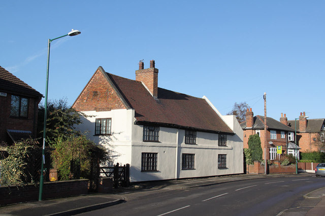
Image: © Alan Murray-Rust Taken: 9 Jan 2013
17th/18th century former farmhouse, with the date 1724 in the gable - difficult to read, better in the larger size image. The rendered finish hides the fact that this is a timber framed building. Listed grade II.
Images are licensed for reuse under creativecommons.org/licenses/by-sa/2.0
Image Location
Latitude
52.927081
Longitude
-1.160386