
The Lamb at Satwell
Introduction
The photograph on this page of The Lamb at Satwell by Des Blenkinsopp as part of the Geograph project.
The Geograph project started in 2005 with the aim of publishing, organising and preserving representative images for every square kilometre of Great Britain, Ireland and the Isle of Man.

There are currently over 7.5m images from over 14,400 individuals and you can help contribute to the project by visiting https://www.geograph.org.uk
The Lamb at Satwell
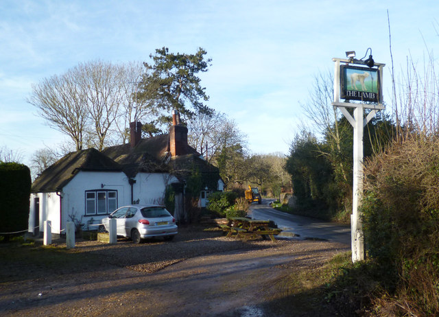
Image: © Des Blenkinsopp Taken: 9 Jan 2013
The same place as in this 2008 shot Image The pub has been shut for some time now, but it's not boarded up or anything and there seem to be people about. The Lamb is yet another casualty in the former Brakspears Henley Brewery estate. Around here there used to be a lot of these beautiful but isolated pub in the woods type places like this one. With next to no local trade, some keep going as restaurants but a lot have closed. Sadly, some country pubs are just too country.
Images are licensed for reuse under creativecommons.org/licenses/by-sa/2.0
Image Location

Latitude
51.545264
Longitude
-0.982866