Guildhall Road, Kingston upon Hull
Introduction
The photograph on this page of Guildhall Road, Kingston upon Hull by Bernard Sharp as part of the Geograph project.
The Geograph project started in 2005 with the aim of publishing, organising and preserving representative images for every square kilometre of Great Britain, Ireland and the Isle of Man.

There are currently over 7.5m images from over 14,400 individuals and you can help contribute to the project by visiting https://www.geograph.org.uk
Guildhall Road, Kingston upon Hull
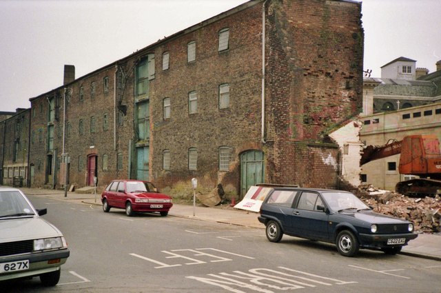
Image: © Bernard Sharp Taken: 15 Apr 1988
The 18th century warehouses on the south side of the road were originally constructed consequential of the building of the New Dock, later Queen's Dock, now the site of Queen's Gardens. Prior to demolition, the warehouses were used by the City Council as offices and for storage of equipment by the grounds maintenance staff. The site is being redeveloped for the construction of new offices for the City Treasury. See also Image
Images are licensed for reuse under creativecommons.org/licenses/by-sa/2.0
Image Location
Latitude
53.744624
Longitude
-0.334591