Nobel Road turning circle, Clifton
Introduction
The photograph on this page of Nobel Road turning circle, Clifton by Richard Vince as part of the Geograph project.
The Geograph project started in 2005 with the aim of publishing, organising and preserving representative images for every square kilometre of Great Britain, Ireland and the Isle of Man.

There are currently over 7.5m images from over 14,400 individuals and you can help contribute to the project by visiting https://www.geograph.org.uk
Nobel Road turning circle, Clifton
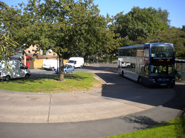
Image: © Richard Vince Taken: 15 Sep 2012
Although it is the official terminus of route 48 from Nottingham city centre via Clifton Bridge, buses do not turn here, instead pausing in it before travelling the whole length of Nobel Road before heading south along Clifton Lane. On a sunny day such as this, it is impossible to contain the whole turning circle in one photo due to its orientation and the topography of the land around it. I must remember to try again on an overcast day from a different angle.
Images are licensed for reuse under creativecommons.org/licenses/by-sa/2.0
Image Location
Latitude
52.899609
Longitude
-1.191542