Ardsheal Hill
Introduction
The photograph on this page of Ardsheal Hill by Rude Health as part of the Geograph project.
The Geograph project started in 2005 with the aim of publishing, organising and preserving representative images for every square kilometre of Great Britain, Ireland and the Isle of Man.

There are currently over 7.5m images from over 14,400 individuals and you can help contribute to the project by visiting https://www.geograph.org.uk
Ardsheal Hill
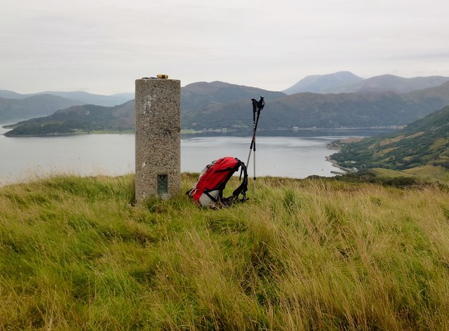
Image: © Rude Health Taken: 31 Aug 2012
Parked at Community Hall, used an overgrown path of sorts but in the end went off-piste to find slim Vanessa trig. Glencoe Youth Hostel power off so did before breakfast and just as rain arrived. ame: Ardsheal Hill Hill number: 230 Height: 263m / 863ft Area: 03B: Loch Linnhe to Loch Etive Class: Ma Grid ref: NM 99516 56841 Summit feature: cairn by trig point Drop: 231m Col: 32m NN002560
Images are licensed for reuse under creativecommons.org/licenses/by-sa/2.0
Image Location
Latitude
56.660338
Longitude
-5.272842