Horley: High Street and Victoria Road
Introduction
The photograph on this page of Horley: High Street and Victoria Road by Nigel Cox as part of the Geograph project.
The Geograph project started in 2005 with the aim of publishing, organising and preserving representative images for every square kilometre of Great Britain, Ireland and the Isle of Man.

There are currently over 7.5m images from over 14,400 individuals and you can help contribute to the project by visiting https://www.geograph.org.uk
Horley: High Street and Victoria Road
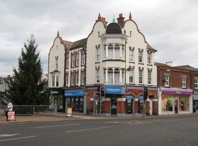
Image: © Nigel Cox Taken: 9 Dec 2012
The High Street is to the left and Victoria Road to the right in this image. The High Street was once called Station Road, but the name had to be changed when the railway moved the station some 300 metres southwards in 1905. From this location one now needs to follow Victoria Road to get to the station. The attractive corner building with its Dutch gables is Number 2 High Street. As a sign of the times it currently houses a branch of the Cheque Centre, although the photographer thinks that it was formerly occupied by a branch of the estate agents Gascoigne Pees.
Images are licensed for reuse under creativecommons.org/licenses/by-sa/2.0
Image Location
Latitude
51.171725
Longitude
-0.16344