View across Leicester city skyline
Introduction
The photograph on this page of View across Leicester city skyline by Mat Fascione as part of the Geograph project.
The Geograph project started in 2005 with the aim of publishing, organising and preserving representative images for every square kilometre of Great Britain, Ireland and the Isle of Man.

There are currently over 7.5m images from over 14,400 individuals and you can help contribute to the project by visiting https://www.geograph.org.uk
View across Leicester city skyline
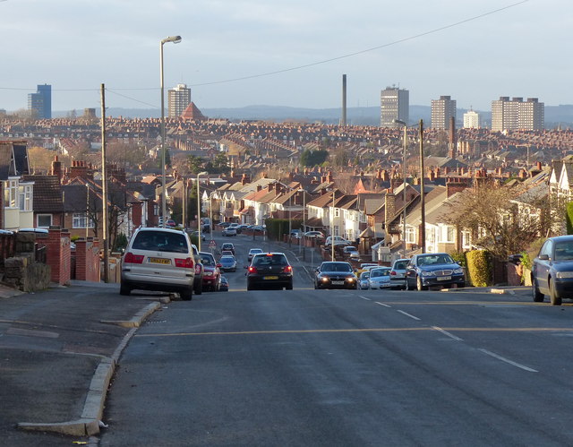
Image: © Mat Fascione Taken: 9 Dec 2012
Looking west along Evington Lane from Horston Hill. The tall buildings visible from left to right are: St. George's Tower on St. George's Way, 82 metres, 20 floors. Goscote House on Sparkenhoe Street, 66 metres and 22 floors. The chimney is on Oxenden Street in Highfields. Cardinal Telephone Exchange on Humberstone Road, 84 metres, 17 floors. On the right are four residential tower blocks in Highfields. Clipstone House, Framland House, Gordon House and Maxfield House. Each 52 metres and 18 floors.
Images are licensed for reuse under creativecommons.org/licenses/by-sa/2.0
Image Location
Latitude
52.623308
Longitude
-1.09796