Train, Knutsford East signal box
Introduction
The photograph on this page of Train, Knutsford East signal box by Albert Bridge as part of the Geograph project.
The Geograph project started in 2005 with the aim of publishing, organising and preserving representative images for every square kilometre of Great Britain, Ireland and the Isle of Man.

There are currently over 7.5m images from over 14,400 individuals and you can help contribute to the project by visiting https://www.geograph.org.uk
Train, Knutsford East signal box
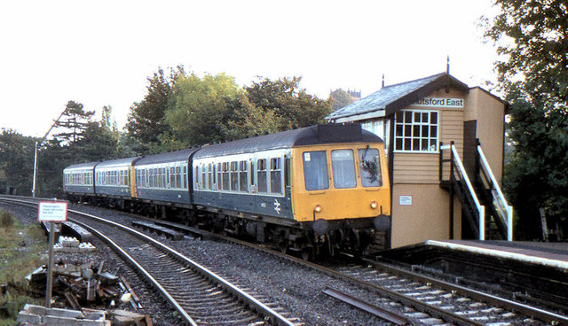
Image: © Albert Bridge Taken: 9 Oct 1984
The 09.00 Manchester (Oxford Road) – Chester dmu passing Knutsford East signal box. It was destroyed by fire in 2000 and subsequently demolished. This link http://www.lineclear.org.uk/knutsfordeast.html has more information.
Images are licensed for reuse under creativecommons.org/licenses/by-sa/2.0
Image Location
Latitude
53.302332
Longitude
-2.370745