
Totally churned up road in The Fens
Introduction
The photograph on this page of Totally churned up road in The Fens by Richard Humphrey as part of the Geograph project.
The Geograph project started in 2005 with the aim of publishing, organising and preserving representative images for every square kilometre of Great Britain, Ireland and the Isle of Man.

There are currently over 7.5m images from over 14,400 individuals and you can help contribute to the project by visiting https://www.geograph.org.uk
Totally churned up road in The Fens
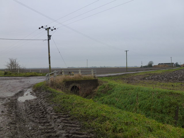
Image: © Richard Humphrey Taken: 19 Dec 2012
Numerous small lanes and roads in Cambridgeshire and Lincolnshire are being wrecked by farm machinery and articulated lorries which appear to get bigger and heavier every year. They are now basically too large for the road infrastructure which was never designed to carry such tonnages. Conditions are particularly bad during the potato and sugar beet harvest at this time of year. This is the crossroads where Flint House Road and Cock Fen Road meet Horsehead Drove between Three Holes and Welney
Images are licensed for reuse under creativecommons.org/licenses/by-sa/2.0
Image Location

Latitude
52.559002
Longitude
0.243896