East side of a railway viaduct, Stonehouse
Introduction
The photograph on this page of East side of a railway viaduct, Stonehouse by Jaggery as part of the Geograph project.
The Geograph project started in 2005 with the aim of publishing, organising and preserving representative images for every square kilometre of Great Britain, Ireland and the Isle of Man.

There are currently over 7.5m images from over 14,400 individuals and you can help contribute to the project by visiting https://www.geograph.org.uk
East side of a railway viaduct, Stonehouse
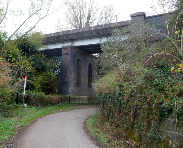
Image: © Jaggery Taken: 20 Nov 2011
This part of the viaduct carries a twin track railway line, part of the Cam & Dursley to Gloucester route. Out of shot on the left, the viaduct crosses over the River Frome. There are no vehicles on the road today because this section of roadway is blocked http://www.geograph.org.uk/photo/3265347 just out of shot ahead. The road behind the camera leads to Ocean Bridge over the Stroudwater Canal. At the November 2011 date of this view, the old Ocean Bridge had been removed in preparation for the new bridge.
Images are licensed for reuse under creativecommons.org/licenses/by-sa/2.0
Image Location
Latitude
51.742157
Longitude
-2.297