Old Folds
Introduction
The photograph on this page of Old Folds by Trevor Littlewood as part of the Geograph project.
The Geograph project started in 2005 with the aim of publishing, organising and preserving representative images for every square kilometre of Great Britain, Ireland and the Isle of Man.

There are currently over 7.5m images from over 14,400 individuals and you can help contribute to the project by visiting https://www.geograph.org.uk
Old Folds
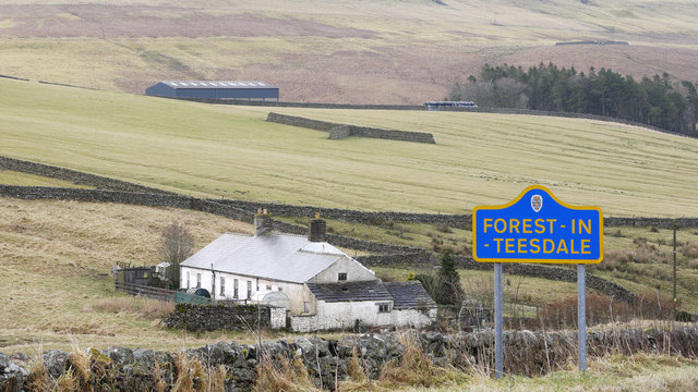
Image: © Trevor Littlewood Taken: 18 Dec 2012
Old Folds is a house in upper Teesdale in the district known as Forest-in-Teesdale. Actually, although this area is surely considered as being part of Teesdale the river draining the ground is Harwood Beck which then flows into the Tees. The blue and yellow road sign is characteristic of a style of signage introduced by County Durham some years ago.
Images are licensed for reuse under creativecommons.org/licenses/by-sa/2.0
Image Location
Latitude
54.678881
Longitude
-2.230271