Titanic Boulevard, Belfast
Introduction
The photograph on this page of Titanic Boulevard, Belfast by Rossographer as part of the Geograph project.
The Geograph project started in 2005 with the aim of publishing, organising and preserving representative images for every square kilometre of Great Britain, Ireland and the Isle of Man.

There are currently over 7.5m images from over 14,400 individuals and you can help contribute to the project by visiting https://www.geograph.org.uk
Titanic Boulevard, Belfast
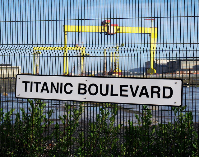
Image: © Rossographer Taken: 16 Dec 2012
Street sign for 'Titanic Boulevard', a short and newly created street running between Sydenham Road and Queen's Road in Belfast's Titanic Quarter. At the time of writing the Google maps have not caught up with it. Behind the fence can be glimpsed the Building Dock and Harland and Wolff with the gantry cranes 'Samson' and 'Goliath' towering above.
Images are licensed for reuse under creativecommons.org/licenses/by-sa/2.0
Image Location
Latitude
54.60345
Longitude
-5.910261