Bentley station, 1990
Introduction
The photograph on this page of Bentley station, 1990 by Ben Brooksbank as part of the Geograph project.
The Geograph project started in 2005 with the aim of publishing, organising and preserving representative images for every square kilometre of Great Britain, Ireland and the Isle of Man.

There are currently over 7.5m images from over 14,400 individuals and you can help contribute to the project by visiting https://www.geograph.org.uk
Bentley station, 1990
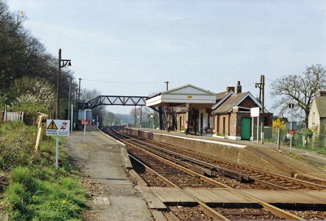
Image: © Ben Brooksbank Taken: 1 Apr 1990
View SW, towards Alton: ex-LSWR London - Aldershot - Alton - (Winchester) line. Comparison with Image] will show little change since 1963, although the important branch to Bordon had finally closed in the meantime (1967).
Images are licensed for reuse under creativecommons.org/licenses/by-sa/2.0
Image Location
Latitude
51.181473
Longitude
-0.867992