Roofs at Milton Combe
Introduction
The photograph on this page of Roofs at Milton Combe by Derek Harper as part of the Geograph project.
The Geograph project started in 2005 with the aim of publishing, organising and preserving representative images for every square kilometre of Great Britain, Ireland and the Isle of Man.

There are currently over 7.5m images from over 14,400 individuals and you can help contribute to the project by visiting https://www.geograph.org.uk
Roofs at Milton Combe
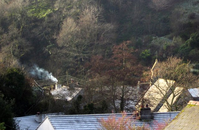
Image: © Derek Harper Taken: 11 Dec 2012
On the right is the roof and belfry of the Church of the Holy Spirit http://list.english-heritage.org.uk/resultsingle.aspx?uid=1326403&searchtype=mapsearch , overlooked, as far as I can tell, by Cherry & Pevsner. Even stranger is that the church is wrongly located on the more detailed OS maps, though the 1:25000 has it right. One feels that one has stepped into Nether Devon in this little village hemmed into a narrow valley.
Images are licensed for reuse under creativecommons.org/licenses/by-sa/2.0
Image Location
Latitude
50.473371
Longitude
-4.132137