Flats, Stamford Street
Introduction
The photograph on this page of Flats, Stamford Street by Robin Stott as part of the Geograph project.
The Geograph project started in 2005 with the aim of publishing, organising and preserving representative images for every square kilometre of Great Britain, Ireland and the Isle of Man.

There are currently over 7.5m images from over 14,400 individuals and you can help contribute to the project by visiting https://www.geograph.org.uk
Flats, Stamford Street
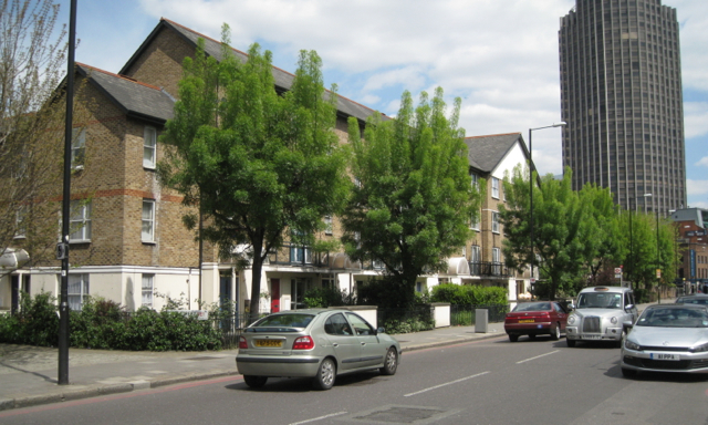
Image: © Robin Stott Taken: 13 May 2012
The London A-Z atlas gives No.100, Mulberry Housing Co-operative in this location. The trees are believed to be Narrow-leaved Ash, Fraxinus oxycarpa; the autumn-colouring variety 'Raywood' is often planted as a street tree. The tall building on the right is King's Reach Tower.
Images are licensed for reuse under creativecommons.org/licenses/by-sa/2.0
Image Location
Latitude
51.506569
Longitude
-0.109659