St Mary Magdalene church and school
Introduction
The photograph on this page of St Mary Magdalene church and school by David Hawgood as part of the Geograph project.
The Geograph project started in 2005 with the aim of publishing, organising and preserving representative images for every square kilometre of Great Britain, Ireland and the Isle of Man.

There are currently over 7.5m images from over 14,400 individuals and you can help contribute to the project by visiting https://www.geograph.org.uk
St Mary Magdalene church and school
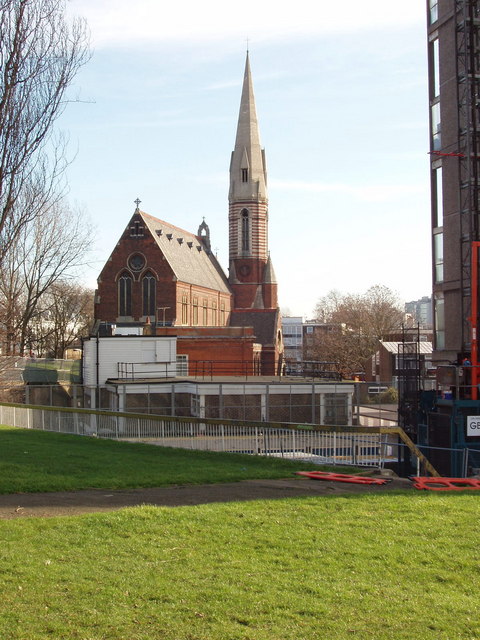
Image: © David Hawgood Taken: 31 Jan 2007
The low buildings between the grassy area and the church are the primary school. On the right is a block of flats.Buildings seen through the trees far left are the other side of the Grand Union Canal.
Images are licensed for reuse under creativecommons.org/licenses/by-sa/2.0
Image Location
Latitude
51.522743
Longitude
-0.188705