Water channel at Drumfrochar Place
Introduction
The photograph on this page of Water channel at Drumfrochar Place by Thomas Nugent as part of the Geograph project.
The Geograph project started in 2005 with the aim of publishing, organising and preserving representative images for every square kilometre of Great Britain, Ireland and the Isle of Man.

There are currently over 7.5m images from over 14,400 individuals and you can help contribute to the project by visiting https://www.geograph.org.uk
Water channel at Drumfrochar Place
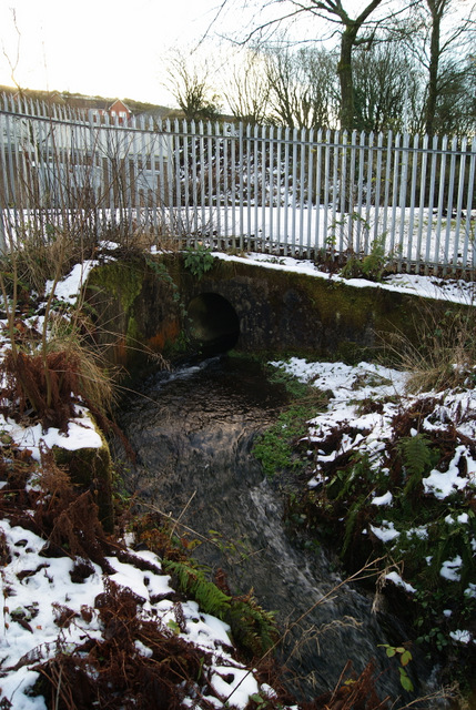
Image: © Thomas Nugent Taken: 4 Dec 2012
This short stretch of fast flowing water is a long disused off-shoot of the Greenock Cut system http://www.geograph.org.uk/article/The-Greenock-Cut . Another section can be seen nearby at Drumfrochar Road Image
Images are licensed for reuse under creativecommons.org/licenses/by-sa/2.0
Image Location
Latitude
55.940988
Longitude
-4.762255