Gray's Hill, Bangor (4)
Introduction
The photograph on this page of Gray's Hill, Bangor (4) by Albert Bridge as part of the Geograph project.
The Geograph project started in 2005 with the aim of publishing, organising and preserving representative images for every square kilometre of Great Britain, Ireland and the Isle of Man.

There are currently over 7.5m images from over 14,400 individuals and you can help contribute to the project by visiting https://www.geograph.org.uk
Gray's Hill, Bangor (4)
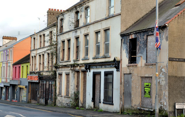
Image: © Albert Bridge Taken: 4 Dec 2012
See Image (December 2011). One year later and this row of shops, at the corner of Gray’s Hill and Primrose Avenue (right) remains derelict (but still standing).
Images are licensed for reuse under creativecommons.org/licenses/by-sa/2.0
Image Location
Latitude
54.66192
Longitude
-5.672594