The former mortuary
Introduction
The photograph on this page of The former mortuary by Robert Lamb as part of the Geograph project.
The Geograph project started in 2005 with the aim of publishing, organising and preserving representative images for every square kilometre of Great Britain, Ireland and the Isle of Man.

There are currently over 7.5m images from over 14,400 individuals and you can help contribute to the project by visiting https://www.geograph.org.uk
The former mortuary
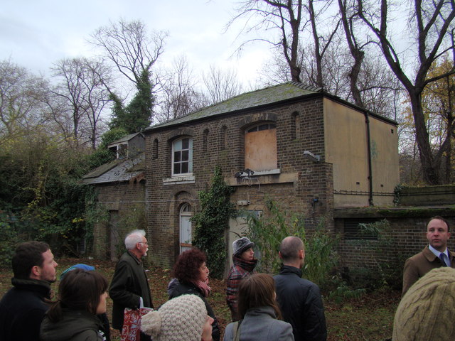
Image: © Robert Lamb Taken: 1 Dec 2012
Now housing the electricity generators of the site. Behind it is the pathway which passes through Tower Hamlets Cemetery Park. Looking south-southeast. If you're wondering how I got access into the site (the site has been closed to the public since 2005), I have two friends from university who are working on a project to convert the hospital site into a Community Land Trust, passed by Boris Johnson last year. Read more about it here: http://www.jtp.co.uk/community-planning-projects/st-clements/
Images are licensed for reuse under creativecommons.org/licenses/by-sa/2.0
Image Location
Latitude
51.524384
Longitude
-0.028338