Tunnel Cottage at Strand-on-the-Green
Introduction
The photograph on this page of Tunnel Cottage at Strand-on-the-Green by Marathon as part of the Geograph project.
The Geograph project started in 2005 with the aim of publishing, organising and preserving representative images for every square kilometre of Great Britain, Ireland and the Isle of Man.

There are currently over 7.5m images from over 14,400 individuals and you can help contribute to the project by visiting https://www.geograph.org.uk
Tunnel Cottage at Strand-on-the-Green
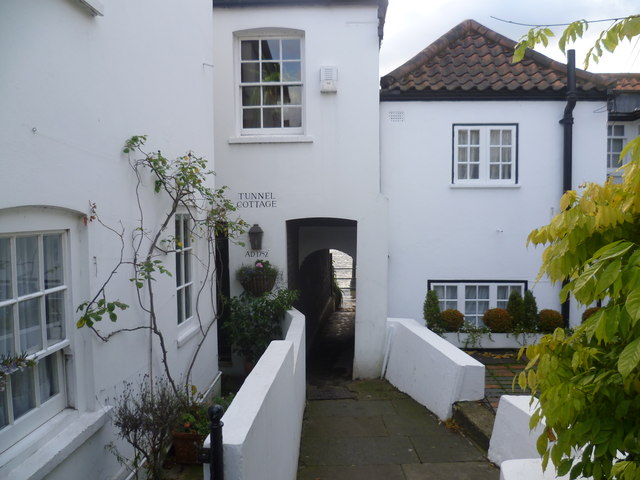
Image: © Marathon Taken: 28 Nov 2012
The riverfront at Strand-on-the-Green consists of a footpath running along the bank of the River Thames. It is overlooked by fine 18th-century houses and a collection of riverside pubs, and as it is on the tideway is regularly flooded by the river, especially when high tide combines with heavy flow from upriver as here in November 2012. The entrance of all the properties is raised above the path so that the view of the river is not spoiled. This is one of the passageways leading from Thames Road to the riverside footpath. The flooded river was literally on the other side of Tunnel Cottage.
Images are licensed for reuse under creativecommons.org/licenses/by-sa/2.0
Image Location
Latitude
51.486283
Longitude
-0.281611