November floods at Umberleigh
Introduction
The photograph on this page of November floods at Umberleigh by David Hawkings as part of the Geograph project.
The Geograph project started in 2005 with the aim of publishing, organising and preserving representative images for every square kilometre of Great Britain, Ireland and the Isle of Man.

There are currently over 7.5m images from over 14,400 individuals and you can help contribute to the project by visiting https://www.geograph.org.uk
November floods at Umberleigh
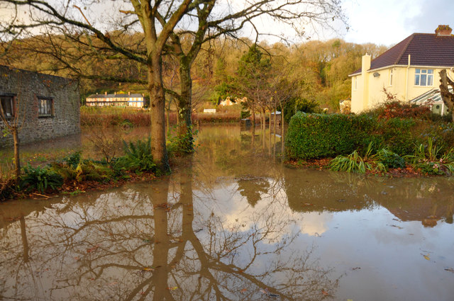
Image: © David Hawkings Taken: 25 Nov 2012
This is the view from the first floor of New Ark, Umberleigh, on 25 November 2012. The house on the right is Taw House. the properties visible in the distance are in Atherington parish on the west bank of the River Taw.
Images are licensed for reuse under creativecommons.org/licenses/by-sa/2.0
Image Location
Latitude
50.993924
Longitude
-3.984904