St Anne and All Saints
Introduction
The photograph on this page of St Anne and All Saints by Nigel Mykura as part of the Geograph project.
The Geograph project started in 2005 with the aim of publishing, organising and preserving representative images for every square kilometre of Great Britain, Ireland and the Isle of Man.

There are currently over 7.5m images from over 14,400 individuals and you can help contribute to the project by visiting https://www.geograph.org.uk
St Anne and All Saints
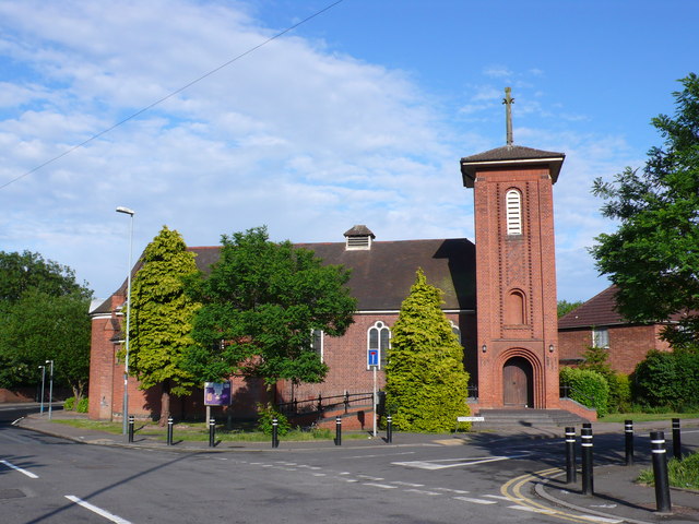
Image: © Nigel Mykura Taken: 11 Jun 2011
The vicar of the church Rev. Clive says "It's great to be a part of the worshipping life of St Anne and All Saints. We are a pretty small, informal CofE church in a part of Coventry that over recent years has become densely populated by students and young adults. We are a multi-cultural, mixed age, inclusive and varied congregation who welcome all. The church building was originally built by a local industrialist as a social centre for his workforce and as a cinema and later gifted to the Church of England. The projection room still exists with portal looking out to what is now the worship area. It’s a place of worship and community and you are welcome to join us. We seek to worship God with authenticity, to learn from His Word, and to live Spirit-empowered lives." The building was originally erected during the First World War by John Davenport Siddeley (created Lord Kenilworth in 1937) as a canteen and recreational centre for munition workers at the Siddeley-Deasy factory, Park Side. The building was given by Siddeley after the war to St. Michael, Coventry, for use as a mission church and was dedicated in 1930 after being enlarged and refurnished, mainly at his expense. Its dedication was that of the medieval Charterhouse which had stood nearby. It comprises a two-story brick building, to which was added, in 1930, a tower above the main entrance in the north wall, small transepts, and an apsidal chancel. The church is on the upper floor and the semi-basement is used as a church hall. It stands on the corner of Acacia Avenue and Strathmore Avenue.
Images are licensed for reuse under creativecommons.org/licenses/by-sa/2.0
Image Location
Latitude
52.402724
Longitude
-1.497711