Koh-i-noor, New Sneddon Street
Introduction
The photograph on this page of Koh-i-noor, New Sneddon Street by Lairich Rig as part of the Geograph project.
The Geograph project started in 2005 with the aim of publishing, organising and preserving representative images for every square kilometre of Great Britain, Ireland and the Isle of Man.

There are currently over 7.5m images from over 14,400 individuals and you can help contribute to the project by visiting https://www.geograph.org.uk
Koh-i-noor, New Sneddon Street
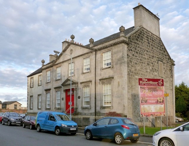
Image: © Lairich Rig Taken: 24 Oct 2012
According to its listed building report, this building, which is also shown in Image (see Image for a view of the rear of the building), dates from the late eighteenth century, and "appears on Semple's 1781 plan of Paisley. Then property of a Mr Lownds." This is a reference to William Semple's "Plan of the Town of Paisley and Suburbs". The name "The Lowndes House" appears in an inscription to the left of the main entrance; this appears to be the most common spelling of the surname. Note the other variations given below. A prominent Lowndes family, perhaps the one connected with this house, was associated with nearby Arthurlie (Image), which is now a part of Barrhead. The Paisley plan referred to above shows what looks like "Lounds Land" (or perhaps "Lounds Lane") cutting across New Sneddon Street. It was certainly known as "Lowndes' Lane" by the 1850s, according to the index of street names given in contemporary commercial directories. New Sneddon Street and Old Sneddon Street both appear, with those present-day names, on Semple's 1781 plan. The plan also shows a Wallace Lane not far to the north of Lounds Land/Lane; there is a present-day Wallace Street in roughly the same area.
Images are licensed for reuse under creativecommons.org/licenses/by-sa/2.0
Image Location
Latitude
55.849975
Longitude
-4.423456