Beeston, NG9 - Town Hall
Introduction
The photograph on this page of Beeston, NG9 - Town Hall by David Hallam-Jones as part of the Geograph project.
The Geograph project started in 2005 with the aim of publishing, organising and preserving representative images for every square kilometre of Great Britain, Ireland and the Isle of Man.

There are currently over 7.5m images from over 14,400 individuals and you can help contribute to the project by visiting https://www.geograph.org.uk
Beeston, NG9 - Town Hall
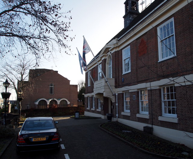
Image: © David Hallam-Jones Taken: 23 Nov 2012
Beeston Town Hall on Foster Avenue is seen here from a footpath at the side of it. Round Hill Primary School is situated behind the photographer. The shield and/or coat of arms are visible on the front elevation sporting some honey bees and several undulating lines. These are from the Beeston and Stapleford crests, the bees representing industry and the two wavy lines, the Rivers Trent and Erewash. The building in the distance is the Catholic Church of Our Lady of the Assumption.
Images are licensed for reuse under creativecommons.org/licenses/by-sa/2.0
Image Location
Latitude
52.927208
Longitude
-1.218548